Reading the Horizon Line in Coastal Landscapes
Learn to read the horizon line in coastal landscapes, distinguish distant ground from nearer ridges, and place the boundary accurately in a sketch.
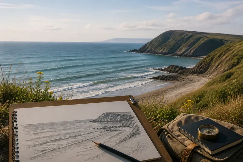
The horizon line in a coastal landscape is an apparent boundary, not a fixed stripe, and identifying what forms it makes a view easier to read. From a beach, it may be the meeting of open water and sky, while a headland or distant ridge interrupts that edge. The observer’s position, terrain, and visibility all shape what appears in the frame.
What does the horizon line mark?
Over open water, the horizon is the apparent limit of the sea surface. It is not a physical seam, and its visibility can soften or disappear in haze, rain, glare, or low cloud. On land, the visible boundary may instead follow a mountain crest, a low ridge, or a distant tree line.
A landscape can contain several edges that seem horizon-like. A nearby hill may cut across the sky, while a lower gap reveals more distant terrain behind it. Naming the feature—open-water horizon, nearer ridge, or distant land—prevents a bold edge from being mistaken for the farthest visible ground.
What can sailors infer from the horizon?
A visible horizon can provide a broad visual reference for comparing the apparent level of the sea with a vessel or distant object. It does not, by itself, establish a vessel’s position or replace navigational tools. A compass, chart, and other suitable navigation methods address questions the horizon cannot answer alone.
Visibility and motion also affect the comparison. Fog or cloud can obscure the boundary, while a vessel’s movement can make nearby water rise and fall in the view. Treat the horizon as one visual cue among others, not as a precise or dependable navigation method.
How does the horizon line shape a sketch?
Its height determines how much of the page is given to sky and how much to land or water. A low placement gives the sky more space; a high placement gives the foreground more room. The choice changes the composition without making either version inherently more accurate.
For a simple sketch, hold a pencil horizontally at arm’s length and compare it with the distant boundary, then mark that height lightly on the page. If the visible edge slopes, first decide whether it follows land or reflects an angled viewpoint; do not force a ridge to look level just because the sea horizon usually appears level.
Say a painter stands on a beach with open water across the view and a dark headland at one side. The starting choice is whether to reserve more page for sky or for beach and water; placing the line low gives the sky greater visual weight, while placing it high gives the foreground more. The resulting sketch has a different balance before any color or detail is added.
How can you distinguish a horizon from a nearer ridge?
Use overlap: if one slope hides part of another, the visible crest may belong to nearer land. Look for gaps where sky or a farther slope appears behind it. A crisp edge is not necessarily closer or farther; haze may soften distant land, while a nearby tree line can remain sharp.
Instead of estimating distance from appearance alone, describe the visible relationships. For instance, note that a dark ridge cuts across a pale slope or that a low saddle exposes sky behind the crest. Those details help explain which forms appear in front without claiming a precise distance.
Which horizon details change how you read a view?
- Height: Check where the boundary crosses the view. If it shifts after you move to a rise, compare the new view from that position; if you need to compare sketches, return to the same viewing spot.
- Continuity: Check where land interrupts the sky edge. If a gap exposes distant terrain, include that form separately; if the edge remains hidden, describe the visible ridge rather than guessing what lies behind it.
- Apparent level: Check the open-water boundary against a reliable level reference, such as a properly leveled railing. If they appear to disagree, check the railing and your viewing position before treating the water boundary as tilted.
- Visibility: Check for haze, glare, rain, or cloud along the boundary. If these obscure it, mark the horizon as indistinct; if visibility is clear, trace the visible edge without extending it through unseen areas.
- Viewpoint: Check whether you are standing, seated, or looking from a rise. If the viewpoint changes, record the new position before comparing the line; if it stays constant, differences are easier to attribute to changing visibility or movement.
- Obstructions: Check whether a headland, tree line, or building blocks the farther view. If it does, label the visible edge as an obstruction; if a gap reveals land beyond, distinguish the farther land from the nearer silhouette.
What questions come up when reading a horizon line?
Is the horizon line always level?
The apparent open-water horizon generally looks level to an observer, but a tilted viewpoint or an unreliable comparison object can make it seem otherwise. On land, ridges and hills commonly make the visible boundary rise and fall.
Is a mountain ridge the horizon?
A ridge can form the visible boundary between land and sky without being the farthest land in view. Check for overlap or a gap that reveals terrain behind it, and label the ridge separately if the distinction matters to the sketch.
Why does the horizon seem to move?
The view can change when you change position, when a vessel moves, or when visibility reveals or conceals distant edges. Keep the viewpoint steady when comparing sketches, or note the change in position so the differing views are not mistaken for a change in the land.
Can a painter omit the horizon line?
Yes. Close foreground forms, cloud, or terrain may fill the frame and leave no clear boundary to draw. Overlapping shapes and changes in slope or tone can organize the composition instead.
How should you use the horizon line in a coastal view?
Start by identifying the open-water boundary, then note where headlands interrupt it and whether a gap reveals land beyond. This makes the horizon line more useful for landscape drawing and visual description, while keeping its role distinct from the tools needed to determine a vessel’s direction or position.
A clear label can be as simple as “open water meets sky; headland interrupts the edge.” It records what the view actually offers and leaves room for uncertainty where haze or terrain hides the rest.